
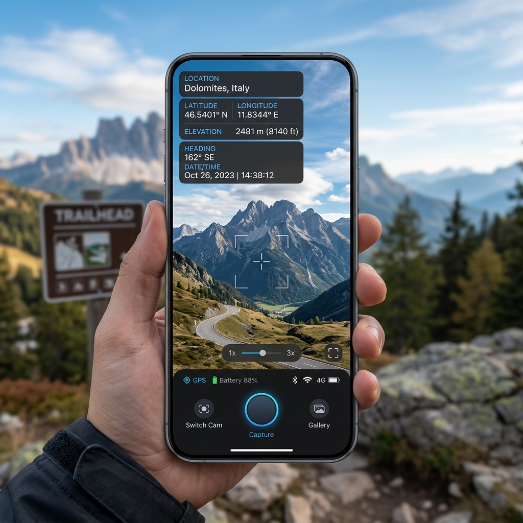
In the era of field inspection, logistics tracking, and real estate documentation, geotagged photos have become a necessity. A GPS camera app embeds geographic information—such as latitude, longitude, altitude, and address—directly into the image file as Exif metadata and overlays it visually on the photo.
In this guide, we will break down the engineering steps required to construct a robust GPS camera app for Android and iOS.
1. Navigating Device Location Services
The foundation of a geotagging camera app is accurate location data. On mobile, we use the Fused Location Provider API on Android and CoreLocation on iOS. For cross-platform developer systems like Flutter, packages like `geolocator` provide a unified interface.It is critical to handle permissions gracefully. Your app must request:
- `ACCESS_FINE_LOCATION` (GPS-level accuracy)
- `ACCESS_COARSE_LOCATION` (Network-level accuracy)
- Background location access (if tracking is needed while the device is locked)
2. Accessing the Camera Hardware
We capture high-quality images using Android's Camera2 API (or Jetpack CameraX) and iOS's AVFoundation. For hybrid development, the `camera` library is standard. To display a preview and capture photos: 1. Initialize the camera controller. 2. Render the live feed in a `CameraPreview` widget. 3. Call the image capture function, which writes the raw byte stream to a temporary directory.3. Writing GPS Exif Metadata
An image is more than pixels; it contains metadata. The Exchangeable Image File Format (Exif) stores technical details. To embed coordinates:- Read the captured image file.
- Inject GPS properties (latitude, longitude, timestamp, altitude) using a library like `exifinterface` (Android/Java) or native metadata dictionaries (iOS/Swift).
- Save the modified image back to storage. This ensures that platforms like Google Maps or database systems can extract the location automatically.
4. Rendering Dynamic Watermark Overlays
To place text details directly onto the picture (e.g., date, project name, location address):- Use a software canvas.
- Convert the image bytes into a canvas object.
- Use paint tools to draw text overlays on top of the bitmap coordinates.
- Export the canvas back into a compressed JPG or WEBP format.
By following these architecture patterns, mobile app developers can build high-utility apps that serve real-world business needs. For expert assistance, hire an experienced app development company like GB Team.